Friday, December 16, 2022

Breakfast of Champions


“A foodie is a person who has an ardent or refined interest in food, and who eats food not only out of hunger but also as a hobby.” Wikipedia.com

We are not really “foodies.” It is true that back in CT we were members of a Gourmet Group for many years. And enjoyed lots of good food at each other’s homes and at local restaurants. But this crowd was as much about the camaraderie as about the cuisine. And for us it still is that way. One thing we really missed during the Covid lockdown out here was having meals with friends at restaurants. We held al fresco, BYO take-out get togethers at ours and other houses – and that took care of the “with friends” part of the experience. But we also wanted the atmosphere of the eatery. Poring over the menu and not limiting our choices to items that “travel well.” Background aromas that lingered on our clothing into the next day. Mouth-watering entrees being whisked past our table to those of other diners – many of which we only enjoy vicariously anyway, because they are just too damn spicy for our unpracticed New England taste buds. But it doesn’t hurt to look, does it? 

“Real” New Mexicans are a blend of Native American, Spanish and Anglo. As a result “New Mexico cuisine is a blend of Native American, Spanish and Anglo tastes. While it shares some traits with Mexican and Tex-Mex cuisine, it is distinctive. Chile (note the spelling) is the main ingredient that makes New Mexico food stand out ... New Mexico Pueblo tribes have been cultivating chile, [and the “three sisters”] corn, beans and squash for millennia.” When New Mexicans refer to chile they are talking about a red or green sauce made from those pods, not chili con carne. In the 1500s the Spanish introduced wheat, rice, beef, lamb and other foods and flavors. “Staples on New Mexico menus include beef and chicken enchiladas, tamales, carne adovada (red chile-marinated pork), burritos, huevos rancheros and chiles rellenos (green chiles stuffed with cheese then deep fried) … Calabacitas [which we do eat and enjoy] is a side dish of corn, squash, chile and beans ... An Anglo influence is New Mexico's beloved green-chile cheeseburger and Frito pie (red chile poured over a bag of Fritos).” (travelchannel.com) Notice how many times “chile” appeared in that one paragraph.

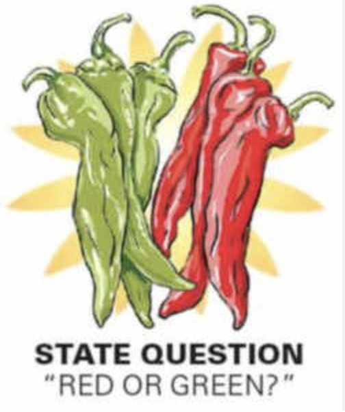
“Red or green (Chile)?” is the “Official State Question.” To which an acceptable answer is “Christmas” meaning both. And the operative word out here is “smothered” with just about everything buried under an avalanche of the spicy sauce – including the first meal of the day.

Just fine with our breakfast buddies L & P – also morning people so 8:00 a.m. gatherings around a social meal are just their cup of tea (so to speak.) We take turns picking the eatery, with the other’s concurrence. Recently we tried Tia Sophia’s in downtown Santa Fe – believed to be the first restaurant on earth to put the breakfast burrito on its menu. “Soft tortillas are stuffed with bacon and hash browns, smothered in melted cheese and served with a poached egg on top” – and buried under red and/or green chile. The dish made the Food Network 2015 list of best breakfast meals across the nation.


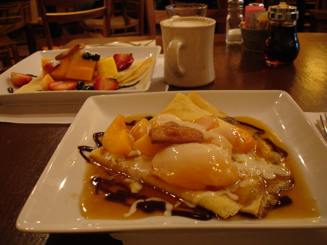
But we did not know all that history until after. Which might have changed our orders – or at least L’s and P’s who selected Huevos Rancheros instead, also smothered. We however went for blue corn pancakes (M) and blueberry pancakes (J) smothered in our “spice of choice” – real maple syrup. We know that we could always ask for the chile “on the side” and spatter it on in harmless helpings. That is, after all, what we advise newcomers to do. But that compromises the entire essence of the entree – its whole raison d'être. And that seems wrong to us. Better to admire it from a safe distance.

During Covid we looked for places with outdoor seating. This brought us back to Cafe Fina – “an old Fina gas station turned eatery” – where first we began our morning get togethers in 2019. The menu features the requisite breakfast burrito, a smothered “huevos” dish (in this case “Huevos Motulenos, over easy organic eggs on a corn tortilla with black beans, feta cheese, peas, sautéed bananas and red or green chile”) – plus lots of things for us heat-averse Anglos including “Migas, scrambled organic eggs with corn tortillas sautéed with mild salsa and NM asadero cheese. served with black beans, sour cream, guacamole and a whole wheat tortilla.” Note particularly the presence of the word “mild” and the absence of “smothered.” 

But not all Santa Fe breakfast bistros had pre-Covid open air seating. Some, like Claflutis a “low-key, French country-style spot for house-made baked goods & light breakfast/brunch/lunch fare,” created a pop up outdoor area in their parking lot under a white tent. 

The two of us discovered Claflutis back in 2005 when Monica and Bram moved to Santa Fe and we began spending Christmas here with them. We rented a casita in the Guadalupe District – west of downtown and, serendipitously, just down the street from the restaurant. (It has since moved to the South Capitol area.) We dined there several times per trip and always on December 24th when we picked up an assortment of French baked goods to bring to M & B’s on Christmas morning.  At Claflutis the “c word” was not “chile” but “croissant” or “crepe.” The latter buried under a pile of fresh fruits or glazed peaches. As was the French toast. Both with syrup made from the sap of non-local maple trees.

Another stop on the L&P&M&J breakfast tour was Cafecito, a “laid-back restaurant & coffee shop crafting Armenian, Argentinian & Italian dishes in an airy space.” We visited it during what passes for a “snow event” out here, but was just another drive in the country to us blizzard-hardened former New Englanders. The objects of our quest were empanadas – among them this Argentinian spin on NM’s mandatory morning meal, the “Breakfast Empanada filled with egg, hash browns, bacon, chorizo sausage, provolone. Served with chimichurri, green chile sauce and mixed greens.” The owner/waitress told us proudly that their chile was mild. And it was in fact quite tame. She also boasted that they never “smothered” anything with anything there.

There have been, and will be, many more breakfast outings. But writing about them is just making us hungry. Perhaps when you visit we can share some of them with you. Until then we will wrap it up with this brief story.

Tia Sophia’s describes itself as a “no-frills, diner-style eatery.” A crowded layout with rows of small wooden booths, narrow aisles, a couple of tables and a food bar. We ate there on the Sunday before election day. As we were leaving, walking single file, we passed the booth next to ours which sat kitty-corner to our route. And saw the incumbent Governor of New Mexico, Michelle Lujan Grisham, having a casual breakfast with two other women. She looked at us and smiled warmly. We reciprocated and when we caught up at the exit asked L & P, “was that the Guv?” They assured us it was. And L went back to say something supportive to her. (BTW It is not that easy to spot MLG in a crowd. At 5’1” she is the nation’s shortest, highest elected state executive. The attached shows her next to a 7’ tall NM State Trooper.)

Her Republican opponent was, like us, a former New Englander (Vermont) – and assumedly raised with a northeastern food palate. We don’t know his position on maple syrup vis-à-vis other “spices” – or what he had for breakfast that day. But Grisham, a 12th generation New Mexican, was feasting on something that was so smothered in red and green sauce as to be unidentifiable. 

She won the election 52% to 46%. 

Did the morning meal choices of the candidates help determine the winner? Probably not. But we will never know for sure, will we? 

Either way, it should be clear to even someone without “an ardent or refined interest in food” (such as us) that chile, and lots of it, is the main ingredient of a “breakfast of champions” out here.   


Tuesday, November 08, 2022

Amalo o Odialo (Love It or Hate It)


(Aerial view of Santa Fe Opera)

We first drove down Santa Fe’s “Opera Hill” heading north on U.S. Route 84 on our initial trip to New Mexico in 1992. Looking in wonder at the seemingly endless high desert landscape Marsha said to herself, “I’m home!” At the other end of town 382 years earlier a considerably less enthusiastic caravan of northbound Spanish settlers stood at the base of the basalt behemoth known as La Bajada and loudly moaned “are we there yet?”

Both we and they were experiencing New Mexico for the first time. And, while the two of us liked to think that we were “exploring” someplace new, we had maps, pamphlets and locals to give us directions, recommendations and advice. El Colonos españoles were doing it for real, with nothing to guide them but their faith in God, their leader Juan de Oñate and the beaten path of the Indigenous Natives who preceded them on the trail that later became known as El Camino Real de Tierra Adentro.

Last year Jim was talking to L, an epidemiologist from Los Alamos National Laboratories. (Apparently not top-secret work, so she didn’t have to kill him.**) During the conversation she mentioned that the Lab does much better retaining employees if they have lived previously in northern New Mexico. Her husband worked at LANL as part of Grad School. She herself was born and raised on “The Hill” – as her town of employment has been referred to since WWII’s Manhattan Project. (At the time the name “Los Alamos” was considered classified information.)

“You either love it, or you hate it,” she went on. Most scientists who quit don’t do it because of the work, but because of landscape and physical environment. Thew same one that we so quickly fell in love with on our virgin visit. Of course we had our return flight booked two weeks out. So either way – not a problem for us. The colonists on the other hand only were given a one-way ticket when they set off on their 1,600 mile, multi-month hike to their future home. Going back was less of an option for them.

The “road” on which the settlers traveled was an ancient trade route between the Southwestern and MesoAmerican Natives. Oñate received permission from the King of Spain to use it for his 1598 and subsequent colonization expeditions and established a settlement in the trail’s terminus San Gabriel – today known by its Native name of Ohkay Ohwingeh. In 1610 Don Pedro de Peralta, Oñate’s successor as Colonial Governor, moved the community back down the road 40 miles to the newly founded town of La Ciudad de Santa Fe de San Francisco (City of the Holy Faith of St. Francis, or Santa Fe for short.)

To which the shortest, but not the easiest, way was La Bajada Hill – an ascension of 1,500 feet in 3/4 of a mile at an angle of 45°. (La Bajada is Spanish for "the descent.") Peralta was also the earliest documented Spanish user of the hill. As the caravans approached Santa Fe there were three choices: scaling La Bajada, following “the Santa Fe River through the yawning canyon of Las Bocas, [or] another, longer trek around La Bajada through the Galisteo Basin,” according to the National Park Service web site. Oñate opted for the third.


(La Bajada with Unidentified Aerial Phenomena – it is New Mexico after all.
Or it could be watermarks if you believe the government.)

In the 20th century there were two alternative principal ways for getting from Albuquerque (where our flight came in) to Santa Fe. Interstate 25 is the most direct and fastest. NM 14 (the Turquoise Trail} more scenic and pleasant. And it turns out that nowadays off of the Santa Fe end of Route 14 is an entryway (entrada) to our home in Rancho Viejo – a 23,000-acre (39 sq. ml.) parcel of land south of the city. The Turquoise Trail was not available to Oñate, et al. But we like to think that these early colonists might nonetheless have passed through what is now our neighborhood. To have that connection to such an historic roadway would be pretty cool.


Documentation shows Oñate’s chosen route brought him to the Native American settlement that the Spanish called Pueblo San Marcos – a short distance from what is today the southern end of the Ranch Viejo property.

A major reason for coming this way was the presence of the Galisteo Creek/River. During the 1800s Santa Fe residents and visitors such as soldiers of both the U.S. Cavalry and the Confederate Army would regularly water their horses, and themselves, at the perennial stream that flows from the eastern highlands down into the Rio Grande through Galisteo. Jim learned all this during a one-on-one meeting he was fortunate enough to have with Dr. Eric Blinman, Director of the state’s Office of Archaeological Studies (OAS.) Jim was researching the history of Rancho Viejo  And Dr. Blinman pointed out that it is a “straight shot” from Galisteo Creek through Rancho Viejo to Santa Fe. Like a lawyer who got the answer he hoped for, Jim quickly changed the subject.

And it was during an evening class at the OAS taught by the same Dr. Blinman where we both learned of the historic significance of La Bajada – although the following comes mostly from the USDA Forest Service website.

Archaeological findings place humans activity at the top of La Bajada Mesa during the early Archaic Period (5500 BC-AD1), a time “when cultures were shifting from reliance on now-extinct mega fauna to smaller game and wild plant gathering. The area provided high quality basalt for stone-tools and a diversity of useful plant and animal species.

“In the few centuries before European contact (AD1300-1600) the population increased dramatically … Archaeologists have identified and dated the remains of several residential sites, known as pueblos, at the base of La Bajada … and large agricultural areas on top of the mesa [such as] grid gardens and … cobble mulch fields. “While it may not seem like the top of the mesa would be a good place to try to grow crops, people from the pueblo below knew how to make the most of the little moisture they received by creating stone alignments that collected and channeled the rainwater. They also used stones to mulch or cover the dirt in which they planted, to minimize evaporation. It is possible that the people who walked across the plateau tending their fields followed a route similar to the historic trail and road alignments that later climbed the same hill.”

Today the NPS cautions, “only the best prepared, and most adventurous, modern-day trekkers will want to take on the black basalt backcountry of La Bajada.” And yet, driven by “God, Gold and Glory,” multiple expeditions of conquistadors and colonos españoles did just that. As did those that came after them, modifying the pathway into todays’ trail, which historians believe has “been in use [in basically that configuration] for some 300 years. The switchbacks on the road were supposedly blazed by U.S. Army troops in the 1860's for cavalry passage. In the early 1900's, because of the gravity-fed gas tanks of the time, many vehicles were forced to use their most powerful gear – reverse – to climb backwards up the steeper switchbacks. In the 1920's, the top half of the climb was rerouted on a gentler alignment just to the east of the old route … In 1934, the Highway Department "moved" the road three miles to the east to the same route currently used by I-25 … The La Bajada [walking] Trail is about 15 miles long and takes approximately 4 hours or so to complete." (New Mexico 4-Wheelers)

(Unclear if the vehicle is coming down or going up.)

 Juan de Oñate not only did not scale La Bajada. He also blew off Opera Hill – or whatever it was known as at the time. His journey north from Santa Fe north to his settlement at San Gabriel took him more than five miles to the west of the awe-inspiring panoramic view that continues to wow the two of us today. We are fortunate to be able say that the Royal Road MAY have passed near our backyard. Having it continue on to our favorite vista in the entire world would be asking way too much of history.

American musician, conductor, arts administrator and Santa Fe Opera founder John O. Crosby learned of the property that would become Opera Hill in 1956, when it was a guest ranch catering to classical music luminaries of the day such as soprano Lily Pons and her husband conductor André Kostelanetz. At the time it was basically 76 acres of sparsely developed land following its previous lives as a pinto bean plantation, a mink ranch and a pig farm. Crosby signed a three year lease and the rest as they say is history.

Was it the price and availability of the land? Probably. Was it the view? Most definitely. Each iteration of the auditorium – 1957, 1967 and 1998 – followed Crosby’s vision of of an open-air theatre that took advantage of Santa Fe’s “ideal climate, natural beauty, and [the] interest of the public in the great southwest.” The building faces west toward Jemez Mountains. To the east the Sangre de Cristos, the southernmost subrange of the Rockies. Panels behind the stage separate to revel a dramatic view of sky and mountains. Performances begin at sunset and, like our experience at a Renee Fleming concert in 2019, are sometimes accompanied by torrential thunderstorms that can drench parts of the audience and the performers.

(Santa Fe Opera founder John Crosby.)

 But as impressive as it is, the Opera grounds do not provide the best view in town. That viewing point was already taken by 1956 – Route 84 in Santa Fe having settled into its current location in 15 years earlier. The vista itself was there long before either of these dates. It was there when the first MesoAmericans walked north from Mexico City to San Juan Pueblo. It was there in 1200 A.D, when the Tesuque Natives created their first Pueblo on part of the land that makes up this panorama. It was there in 1598 when Juan de Oñate went north to proclaim the Pueblo of San Juan as the first Spanish settlement in New Mexico. It was there when we first drove north out of Santa Fe in 1992. And it will be there should you decide to take that same ride down Opera Hill.

1,900 of our words cannot adequately describe it. Nor can an IPhone video shot at 75 mph capture it. You have to see it in person to decide. You’ll either love it or you’ll hate it. You already know how we feel.
(Getting to “The Hill” ca. 1945)


olor de santidad


Written 5/9/22


So yes – there are fires out here.  Not in our backyard, but one is 35 miles to our west.  And another – at the moment the largest in the country – is the same distance to our east.  Similar to being in Wethersfield and having blazes in New Haven and Springfield, MA.  But our here because of the landscape we can see both from our neighborhood.  Below, sunset in the Jemez Mountains (smoke not clouds) out our back yard.  And the Sangre de Cristo mountains to the east taken from up the street a bit – note the dry landscape.

Its early in the year for such things.  The Governor has already declared a State of Emergency and is warning of the worst fire season ever.  Feds have sent their entire fleet of fire-fighting "super scooper aircraft."  They are housed at the Santa Fe Airport and we’ve seen them flying over our neighborhood dangling buckets of water that look pitifully small for the task at hand.  No rain in our two-week forecast.  None in the past couple of months.  Winds at 20 to 75 mph in the fire areas spreading sparks.  Not good at all – but not personally worrisome for us yet.


So, even with all this going one, what are the top three things to do in Santa Fe? Most locals will tell you it is hiking, visiting museums, and eating out – the City Different Triathlon. Good by us. The high desert paths and arroyos in our community provide plenty of opportunities for foot traveling – but alas no art or gourmet opportunities. However more trails, a walkable downtown area, over 20 cultural institutions and triple that number of restaurants are all within a half-hour drive – making the CDTri pretty doable on any given day. Good thing, since it requires constant repetition to keep in top competitive condition.

One recent training session involved some urban hiking, lunch at our favorite “low-key, French country-style” eatery and exhibitions at two of Santa Fe’s downtown museums. The first pair worked up an appetite and then satisfied it. While the culture part brought back memories of our early visits to northern New Mexico. “Western Eyes: 20th Century Art Here and Now” at the Museum of Art reminded us of what made us think of coming out here to begin with. And History Museum’s “Curative Powers: New Mexico’s Hot Springs” told the story of what became a regular part of our annual visits to this part of the world.

So, what did make us think of coming out here to begin with? Well, for our 25th wedding anniversary in September, 1992 we were looking to go someplace special. That spring we happened to attend a retrospective of Georgia O’Keeffe paintings at the Museum of Modern Art in New York City. From 1979 to 1989 the Wadsworth Atheneum in Hartford had mistakenly displayed her painting “The Lawrence Tree” upside down – so we had some, albeit skewed, familiarity with her work. That image, plus other bits and pieces of her art and life, were enough to make us want to see more. And more was what there was at MOMA. We became really hooked on her southwestern paintings. And decided “let’s go see the place that inspired all these abstract pictures.”

So we came. And they weren’t abstract. But they weren’t representational either. To help explain, lets jump ahead to that April 2022 exhibition of “southwestern modernist painting” – literally in the middle of which, both positionally and stylistically, was Georgia O’Keeffe. At one end were paintings whose “subject matter” consisted of a collection of colored dots. At the other, posed-in-the-studio, photo-realistic depictions of Native Americans.

The O’Keeffe canvas portrayed a vertical somewhat luminescent turquoise rectangle inside a larger horizontal version of the same shape in an earthy, warm desert tan. On closer inspection – meaning you had to mentally step back and fill in the “whole picture” based upon your experience with northern New Mexico sights – it is a close-up view of the front door and wall of an adobe house. But thirty years ago we didn’t have that knowledge base. So we started to look at the landscape and architecture more O’Keeffe-ly. And it really was all there to see – well maybe not the sun-bleached cow skulls floating in the clouds – but still. We wanted to see more. So kept coming back for the next 25 years until at last we were able to stay. We are still “learning to look” as our old college art history book was titled.


On that first visit we made a day trip from Santa Fe to “take the [hot spring] waters” in the town of Jemez Springs, 90 minutes or so from our temporary home base. (And the origin point for the current fire to our west.)  To our east coast eyes pretty much anything outside of New Mexico’s state capital was southwest rural – with a capital R. Two-lane roads with nothing beside them other than high desert nothingness. Little if any traffic in either direction. And no real idea of what lay ahead. Somewhat disconcerting for two Connecticut suburbanites – with a capital S.

Looking for lunch we came upon an outdoor restaurant surrounded by a pack of parked motorcycles. A biker bar in an unfamiliar town on an unknown back road – what could possible go wrong? Hunger overcame anxiety. And we were seated in the midst of a “gang” of polo-shirted men many of whom were audibly communicating with their stock brokers on cell phones, while the remainder sipped their ice teas and Pellegrinos. Then we noticed that none of the carefully parked choppers had the distinctive Harley Davidson emblem on them. In fact many bore the same three letter brand name as the German luxury cars within which their owners likely commuted to their day jobs.

After our meal we set off in search of the hot springs, whose past is what has now become a familiar storyline to us. Ancient Natives – in this case the Pueblo of Guisewa – were the first and only residents and users of “the waters” until the late 1500s. Followed by the Colonial Spanish (1598-1821), Mexicans (1821-1847) and then the Anglos (1847-today.)
We must pause briefly here to point out the Spanish conquerers’ ideas of cleanliness when they first arrived in the New World. “Many things about Aztec civilization amazed the Spanish Conquistadores … But probably nothing seemed more bizarre … than the Aztec attitude to personal hygiene. [Around 1520] conquistador Andres de Tapia reported, in a tone of wonder, that [Emperor] Montezuma bathed twice a day.” No big deal since according to the Jesuit historian Francisco Javier Clavijero “everybody bathed often, and many of them every day in the rivers, lakes or pools.” (“Clean Aztecs, Dirty Spaniards” www.mexicolore.co.uk.)

Following advice from the medical faculty of the University of Paris that the Black Death of 1347 was caused by “hot baths, which created openings in the skin [allowing] disease to enter the body,” the people of Europe pretty much avoided water for the next 400-500 years. The Spanish had an additional reason. “When the Visigoths conquered Spain in the 5th century, they scorned hot baths as effeminate and weakening, and they demolished the bath-houses. By the time the Moors invaded the country in 711, the Spanish … saw the Moors’ well-washed ways as part of their heretical convictions, and their own dirtiness as a Christian virtue.” To the mendicant monks physical dirt was THE test of moral purity and true faith. “By dining and sleeping from year’s end to year’s end in the same unchanged woolen frock [they] arrived at the height of their ambition … the odor of sanctity, the ‘olor de santidad.’”

But fortunately not forever. According to “Policing Waters and Baths in Eighteenth Century Mexico City” (jstor.org) – “In Spain, after a century in which bathing – especially social bathing – was discouraged, outlawed, and largely eradicated, people took to the water again in the 1600s. During that same period in Mesoamerica the conquerors repressed the sexual, social, and religious aspects of temazcal [sweat lodge] steambathing in favor of bathing for health and medicinal ends, a negotiation which enabled the temazcal as an institution to survive and spread across racial, ethnic, and class boundaries. Moreover, bathing in hot springs had surged back into popularity … was considered therapeutic, and the mineral waters themselves were thought to be medicinal.”

Just in time for the Spanish colonization of New Mexico – where for hundreds of years Pueblo Natives had considered hot springs as sacred places, and believed in the miraculous healing powers of the heat and mineral waters. Some soaking pools were even declared DMZs within which warriors could rest and not be harassed by other tribes. (Aztecs and Pueblo Natives are not related but share a similar cosmology and theology, and pretty much identical personal hygiene regimes. For the “pagan” Indigenous People cleanliness was next to godliness. Their Catholic proselytizers, not so much. In fact, there was a time when they appeared to be more water-fearing than God-fearing.)

The occupying Spaniards however seem not to have interfered with the Native’s ablution apparatuses. Nor the follow-on Mexican rulers. Enter the Anglos to monetize Mother Nature. Around 1860 one of the Jemez hot springs erupted, creating what should have been a temporary pool. But – cha-ching! – it was quickly enclosed with a rock wall and surrounding building, one of the first structures in the town. By 1881, a bath house and hotel were erected to accommodate travelers who came from as far away as Albuquerque to take the plunge – the beginnings of “health tourism.” Over 100 years later the two of us traveled from Santa Fe to soak and relax, ease our aches, absorb the beneficial minerals and rid our bodies of its harmful toxins. Or so we hoped.

The pools turned out to be individual tubs – some in a women’s section and some in a men’s. Their were no other customers. We paid our fees, signed the necessary releases, went our separate ways and settled into our respective indoor bathing containers for 45 minutes of uninterrupted soaking in the thermally heated, mineral-laden delightfully relaxing waters. After which we were gently peeled out of our aqueous cocoons and poured back into our rental car for the languid drive back to our Santa Fe motel. In the distance we saw our first high desert thunderstorms and then drove through them. Jim spontaneously broke into heavy perspiration necessitating the use of a towel we accidentally purloined from the bath house. The last vestiges of his east coast toxins. We knew we would repeat it again. But this time in an al fresco setting.

Which we found the next year among the Sangre de Cristo Mountains at Ojo Caliente Mineral Springs in the eponymous town of Ojo Caliente, 60 minutes or so from our Santa Fe home base. (“Ojo caliente, “hot eye,” was the name the Spanish gave to all the hot springs they found in New Mexico.)

Ojo’s backstory is similar to Jemez Springs. Native American Tewas, to whom this was a sacred site, were the first to soak in the springs. Their Pueblo community, Posi-ouinge (“village at the place of the green bubbling springs”) was the largest of four prehistoric Indigenous villages studied by New Mexico archaeology all-stars Adolph Bandelier and Edgar Lee Hewett. The only historic record of Spanish or Mexican use of the pools we found was an 1807 report saying the former brought Zebulon Pike (American brigadier general and explorer) there for a dip. Pike was already in hot water after his arrest for his “incursion” into New Mexico.

Then in 1868, Antonio Joseph, New Mexico’s first territorial representative to congress, built the initial bath house. Soon the town of Ojo had overnight lodging, a post office and a general store at which ledgers show frontier legend Kit Carson purchased supplies. In 1916 the then-owners built an adobe hotel to house their guests. Per Facebook, Ojo “is one of the oldest natural health resorts in the United States, and the only hot springs in the world with … four different sulfur-free mineral waters [lithia, soda, arsenic and iron.]” By the time we went there Ojo had added more buildings plus massages and other treatments – and relabeled itself as a “resort and spa.”


(Ojo Caliente Mineral Springs in 1916.  
Seems like most of the paying guests still can’t quite get the hang of soaking...)

Our initial visit was a day trip where we hopped from one outdoor mineral pool to another (with recovery time between dips) and went home so relaxed that we decided next time to spend several days. We did the next year – staying in the adobe hotel, having massages, mud baths, facials, wraps and more. Then came back for a few days on pretty much every subsequent visit to NM.

Our new state of residence is home to at least 77 natural mineral hot springs. Radium Springs, near the southern city of Las Cruces, is the hottest and strongest such spring in the world. Geronimo, the famous Apache Chief, made camp nearby, so he and his warriors could bathe in the revitalizing waters. Spanish settlers tired from their long trek up the El Camino Real de Tierra Adentro (The Royal Road of the Interior Land) discovered the beneficial powers of the Radium Springs. As did U.S. soldiers from Fort Selden 200+ years later. It is not necessarily true that those cavalrymen made easier targets at night.

60 miles north the indigenous people of that area enjoyed their own local hot mineral springs. In the late 1500s the Spanish arrived, naming it Ojo Caliente de Las Palomas (Hot Springs of the Doves) and establishing it as a stopping point (paraje) on El Camino Real. By the late 1800s, bath houses and lodging popped up to accommodate visitors. The name of the town was anglicized to Palomas Hot Springs and it became a popular therapeutic destination. In 1916 they dropped “Palomas” and incorporated as Hot Springs, NM. Then in 1950 the locals accepted an offer from a popular NBC radio game-show and renamed the town “Truth or Consequences” – “T or C” to New Mexicans.

The hot springs at T or C are on our radar as part of a return trip “down south.” We had gone to that part of NM for the first time literally days before the pandemic shutdown. But did not take the waters. Maybe this year we will – paired perhaps with a viewing of Bosque del Apache's annual fall migration of sandhill cranes, snow geese, and ducks about one hour away. Next door by New Mexico standards.

Also, Ojo Caliente has opened an outpost next door to El Rancho de las Golondrinas – our volunteer gig and formerly the northernmost paraje on on El Camino Real. Ojo Santa Fe offers “thermal soaking pools ... with triple-filtered water from our own natural aquifer, which we gently heat to varying therapeutic temperatures so you can soak to your body’s content.” (The same water source in un-purified form irrigates El Rancho’s farm fields.) Ojo SF also offers an artificially salinated 80° lap pool to remind us of our Cape Cod, CT Shore and North Carolina ocean experiences. Well maybe not so much the northeast part.

But our own local spa of choice is Ten Thousand Waves – “inspired by the great Japanese mountain hot spring resorts … ten minutes from downtown Santa Fe, but only minutes from the National Forest.” We were introduced to it by Monica and Bram after they moved here and we began visiting over the Christmas holidays. A hot-soak on the hillside in sub-freezing temperatures under starry skies became a new December tradition. Followed by dinner at a local BBQ eatery. The Steamy Heat & Smokey Meat Biathlon. Even die-hard Triathletes need some R&R.

(…but we, on the other hand…)


¿Qué es una ciénega?


Our former Connecticut neighbor Mark Twain was fond of saying, “if you don't like the weather in New England now, just wait a few minutes.” He should have added “or New Mexico.”

We began writing this issue of CMiNM on March 27 in sunny 70° temperatures. (Our thermometer in the sun on the placita (patio) actually read 100.) This was preceded by two days of the same – and followed by one more – then five days of snow showers, clouds and 50°. Three days before the heat wave it snowed enough to prompt outrage from school parents about the failure to cancel that day’s session. Being experienced New Englander drivers we however kept our 8:00 a.m. engagement that morning for breakfast with friends at an empanada restaurant a half-hour into town. The ice fog was a first-time experience for us out here. But the rest was, “been there, done that.” As this essay progressed from idea to draft to editing, the weather likewise has been inching its way spring-ward. And April 6 at 3:50 PM, MDT we saw our first official sign of that season’s arrival – the initial whiptail lizard of 2022 scurrying along one of our neighborhood sidewalks after having spent the winter hibernating in her shelter. (They all are female.) That night’s low was 28°. We hope the little lady didn’t jump the gun. But we’ll probably never know. They do all kind of look alike.  BTW yesterday was 49° and sunny with winds gusting up to 50 mph.

We’ve been having all-day training sessions at El Rancho de las Golondrinas on three Saturdays in March and one in April – mornings on Zoom and in-person afternoon tours of the property.

We took advantage of our time at the initial onsite to walk the Torreón Trail, one of our favorite parts of the 200-acre property. The pathway, which begins in a scenic portion of the property’s ciénega, was once part of El Camino Real de Tierra Adentro and is the former site of a textbook Comanche raid in June, 1776.

Lots of unfamiliar Spanish Colonial stuff. Right? So first, who was this Torreón person anyway?

Actually Torreónes ("fortified buildings" or "towers") were circular defensive structures similar to English castle keeps or French donjons – and were a common sight throughout northern New Mexico during the Spanish colonial period. Some were scattered around the landscape for settlers to take shelter in during attacks when they were out working in the fields or otherwise away from their home base. Others were a tall safe-room in a hacienda. In both instances the structures also served as a lookout from which the watchman (usually a 12-14 year old boy) could see whether incoming groups were coming to socialize and do business, or raid and pillage. Archeological excavations confirm that the Torreón whose remains can be seen at the end of the short walking path at las Golondrinas was built in the 18th century.

What allowed New Mexico to be settled, and what kept it going for its first 200-plus years, was the two-way trade with Spain via Mexico on El Camino Real de Tierra Adentro (The Royal Road of the Interior Land) – the northernmost of the four main Caminos Reales that linked Mexico City to its major cash cows in Acapulco, Veracruz, Audiencia (Guatemala) and Santa Fe. Long before the arrival of the Spanish, the Indigenous Peoples of the Valley of Mexico had established the route to support their own flourishing commerce in turquoise, obsidian, salt and feathers with customers as far away as the Rocky Mountains. Beginning in 1598 EVERYTHING that came into or out of Spain’s northernmost colony traveled on this 1,600 mile road, which actually ended at San Juan Pueblo (now known as Ohkay Owingeh) 25 miles north of Santa Fe. Travelers covered 8-10 miles day. Six months one way.

The roadway passed through what today are the neighboring Census-Designated-Places of La Ciénega and La Ciéneguilla in Santa Fe County. El Rancho de las Golondrinas is located in the former of these two unincorporated townships (just 15 minutes from the current site of “Casa Meehan.”) During the 18th and early 19th centuries the ranch was one of many “parajes” or stopping places along El Camino Real at which journeyers would rest, swap goods, replenish supplies, and prepare for the next leg of their journey. Like the long-running Italian tavern near the Hartford-Wethersfield line back in CT, las Golondrinas was the “First & Last” stop coming from or going to Santa Fe – but without the pizza and beer. It is generally accepted that today’s 1/4 mile Torreón Trail was its entry way to El Rancho.

The Royal Road roughly followed the path of the Rio Grande through New Mexico. Good enough for traveling. But a place with a permanent source of water – such as a ciénega – would have had any real estate developers in the caravan lusting for the land. As you can see from the name of its hometown, las Golondrinas was and is in such a place. So, ¿Qué es una ciénega?

“Ciénega is the Spanish word for ‘marsh,’ but it has also become an ecological term for a stable spring-fed wet meadow … in an otherwise, arid region – like an oasis in the desert. Arid-land spring ciénegas are very rare... Prehistoric and historic people of arid southwestern America have relied upon and exploited these uncommon sources of water and lush vegetation.” (streamdynamic.us) There are 169 identified ciénegas in New Mexico – most small and non-functional. The numerous springs and spring brooks within the one at las Golondrinas are created by igneous intrusions that force the aquifer to surface – most notably at the pond adjacent to the museum property in Leonora Curtin Wetland Preserve from which El Rancho draws the water to power its large grist mill, and  at the small bodies of water that run along both sides of the Torreón Trail.

The ciénega also was something that the Indigenous Tano residents of Pueblo Ciénega (aka Pueblo Mesita) and Keres villagers at nearby Pueblo La Ciéneguilla took advantage of as early the 14th century. The exact site of the first-mentioned settlement is still uncertain. Remains of the latter have been found adjacent to mesas adorned with pre-Columbian native petroglyphs – now a hiking area under the control of the Bureau of Land Management. History tells us that both communities took part in the 1680 Pueblo Revolt. The drought, crop failure and famine, which were contributing factors to the uprising, did not however go away when the Spanish did. Many villages closed down and their occupants moved on to other Pueblos. It would seem that those sitting on a permanent water source should have survived. But Pueblos Mesita and La Ciéneguilla did not. The Spanish returned and reconquered New Mexico in 1692. King Philip V issued a Community Land Grant for La Ciénega in 1710 under which Miguel de la Vega y Coca and others established ranches that became known as El Rancho de las Golondrinas. La Ciéneguilla was begun under a Private Land Grant to Francisco Anaya De Almazan, but did not begin developing until the family sold the land in 1760.


In recognition of the Torreón Trail’s historic status the National Park Service has placed signage along the route. The last one of which tells about the June 20, 1776 “Attack at the Torreón” when “a party of Comanche warriors swept through the Spanish ranchos of La Ciénega … and La Ciéneguillia … killing nine men and boys and taking two young children captive. Antonio Sandoval, the owner of El Rancho de las Golondrinas, lost his 19-year old son … and nephew … who were killed as they tended crops. Scenes such as this were typical on the northern frontier.”

The Comanche Nation occupied and largely controlled significant portions of the southern plains including North, Central and West Texas as well as most of New Mexico – an area larger than all of New England (over 72,000 mi².) Historians such as Pekka Hämäläinen argue that this “Comancheria” fit the definition of an empire.

Interestingly though there was no central tribal authority in the Comanche Nation, but rather a number of largely independent sub-tribes (bands) who would periodically join forces to attack their enemies. This decentralized organization was something that the Spanish and U.S. authorities never quite caught on to as they would negotiate one unsuccessful treaty after another with chiefs whom they mistakenly thought spoke for the entire tribe. Little difference – since in many cases the U.S. in particular never intended to honor the terms of the agreements anyway. And the Comanche were mostly in it for the door prizes (aka bribes) such as horses and armaments. Only Don Fernando de la Concha, New Mexican Governor from 1787-1793, was able to achieve a period of conciliation with the Comanche. “Through his imaginative use of balance-of-power diplomacy [he] consolidated peace with troublesome Indian groups and effected a decade of stability and modest economic prosperity in New Mexico,” according to “Balance of Power Diplomacy in New Mexico.” by Jack August published in digitalrepository.unm.edu.

The Comanche operated a highly successful “raiding economy” beginning in 1706 with sudden attacks on the Spanish colonies of New Spain that continued until the last bands of the tribe surrendered to the United States Army in 1875.

In his highly readable work “Empire Of The Summer Moon,” S C Gwynne writes, “no tribe in the history of the Spanish, French, Mexican, Texan, and American occupations of this land had ever caused so much havoc and death. None was even a close second.” He describes in detail the “demonic immorality of Comanche attacks [in which] torture, killings and gang-rapes were routine … The logic of Comanche raids was straightforward, all the men were killed, and any men who were captured alive were tortured; the captive women were gang raped. Babies were invariably killed.” According to dailymail.co.u, “Texans, Mexicans and other Indians living in the region all developed a particular dread of the full moon – still known as a ‘Comanche Moon’ in Texas – because that was when the Indigenous raiders came for cattle, horses and captives.”

The Comanche became expert horsemen, taking full advantage of the equines that the Spanish had introduced to the Americas. The Natives initially acquired them by trading and raiding; then by taking possession of many of those left behind when the Spaniards were driven from New Mexico in the 1680 Pueblo revolt; then by more and more raiding. Just like in the movies the Natives were able to swing down to the side of their mount and shoot arrow after arrow from behind the protection of the steed’s neck. They brought spare rides with them on their forays – swapping from one to another as they made their escapes and sometimes riding as much as 100 miles with their captives before stopping. A Comanche War Chief’s status was measured by the number of horses he owned. All of which were destroyed upon his death.

Conflicts with the Comanche ended in 1875 when the last of the tribe surrendered to the United States Army – thus, among other things, making the Torreón Trail safe for our Golondrinas guests. Yet the pathway remains the least visited site at the museum. This, we believe, is largely due to its location at the top of what is labeled “steep hill” on the attached map. (Torreón Trail is the snake-shaped set of dashes to the right.)


The normal and recommended staring point for tours of the 200-acre museum is the 18th century Spanish Colonial Golondrinas Placita (#1.) From there guests exit through the back past the churro sheep pen (#13), into the 1820s Mexican Period Baca Placita (#s 15-18) and then down a gently-sloped incline across the creek and into U.S. Territorial times on the “far side" (31-46.) After the uphill and downhill trek on rocky terrain around the 1847-1900 loop, mostly in the unfiltered and un-abating New Mexico sun, our visitors choose between the more direct but also more strenuous “steep” hill, or the longer but more gradual path on which they came down earlier from the upper ranch. The majority opt for the latter, completely missing the opening to the Torreón Trail. Most of those that choose to storm up the big hill may see the small sign pointing the way to the defensive tower, but they are gasping too hard to have any interest in adding another half-mile to their day’s step-count. Or if not they are, as we say, all “museum-ed out” from trying to absorb 200 years of the past in 200 minutes in the sun and heat.

We point them to the nearest shaded area and make sure that they have enough hydration. And – since most of our guests do return – suggest that on their next visit they begin with a gentle stroll through our on-site oasis along the earliest Euro-American trade route in the United States out to the place that made 1776 such a special year in New Mexico history. A solitary saunter is nice. A partnered promenade is better. An excursion with one of our volunteer interpreters is best.

As Mark Twain tells us, “the true charm of pedestrianism does not lie in the walking, or in the scenery, but in the talking... the scenery and the woodsy smells are good … but the supreme pleasure comes from the talk.”

Especially when you are literally immersed in the subject matter.